Dallas postcodes map
You can find on this page the Dallas zipcodes map to print and to download in PDF. The Dallas zip code map presents postal codes, address lookup and code list of Dallas in Texas - USA.
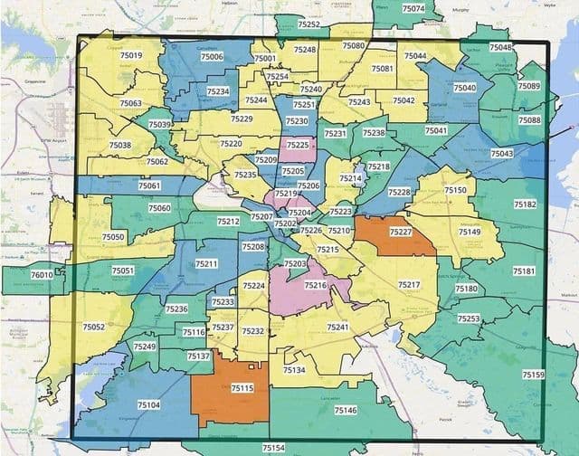
Dallas postcodes map
The Dallas postcodes map shows all the zip codes of Dallas. This zip code map of Dallas will allow you to easily find postal codes and address lookup of Dallas in Texas - USA. The Dallas postcode map is downloadable in PDF, printable and free.
Dallas is the actual or alternate city name associated with 105 postcodes by the US Postal Service. The Residential addresses are segmented by both Single and Multi-family addessses. Each individual Dallas postcode profile also includes Demographic Data including Population, Housing, Income, Households, and Growth Rates. Dallas, TX - Standard postcodes as you can see in Dallas postcodes map: 75201 75202 75203 75204 75205 75206 75207 75208 75209 75210 75211 75212 75214 75215 75216 75217 75218 75219 75220 75223 75224 75225 75226 75227 75228 75229 75230 75231 75232 75233 75234 75235 75236 75237 75238 75240 75241 75242 75243 75244 75246 75247 75248 75249 75251 75252 75253 75254 75260 75270 75287 75398.